
The Lost Coast in northern California has been on my “must do” list since I first heard about the area over seven years ago. A trip to the region is logistically challenging to pull off from Colorado without taking too many vacation days so I begrudgingly I added to my growing “someday” list.
But this past spring, the backpacking gods blessed me. I was chatting with a best friend about swapping dresses worn to various weddings over the last summer {we’re both at 27 Dresses and counting} when she mentioned she was leaving in five days to hike the Lost Coast. My heart skipped several beats – I was between jobs and I had an abundance of airlines miles. “Um, I want in! I’ll see you on Sunday.”

King Range NCA
The Lost Coast is the remote area where California’s Highway 1 ventures away from the ocean to head inland leaving a large swath of coastline difficult to access via a road. The King Range National Conservation Area was created in 1970 to protect this unique landscape. It stretches 35 miles along the coast and covers 68,000 acres.
After a few requisite trips to REI and Trader Joes and a swanky stay in Napa, our group of three ladies departed for the Kings Range BLM office to secure permits and confirm our itinerary. A stop at the BLM office is also necessary to pick up a tide map and rent a bear box if needed. The office is 3 hours from Healdsburg where we stayed or 4.5 hours from San Francisco and is only open Monday through Friday which can add to the challenges of accessing this area.

Tide table
The traditional Lost Cost hike is a one direction 35 mile hike along the coast. Nearly everyone recommends hiking north to south so the wind remains at your back. It is necessary to have a tide map and plan your route in advance because at high tide some of the sections of the trail are impassable.
According to trip websites, there are shuttle services available to make the trip possible with one car and minimal shuttling. However, this area is REMOTE. Cell service doesn’t work. The shuttle service listed on the website we tried to call never picked up the phone. We’d also heard a bummer of a story from a friend who was able to book the shuttle, but it never arrived to pick him up. We opted for two cars. We left one car at the Black Sands Beach and hopped back in the car for another 2 hours drive up to our starting trailhead at Mattole. I mentioned this is logistically challenging, right? The driving, permit obtaining, car shuttling, etc. took us an entire day. We pulled into the campsite at Mattole just in time to start a fire and cook some dinner. We camped at a designated site that night and left all our unnecessary items in the car the next morning to be picked up there in 3 days.

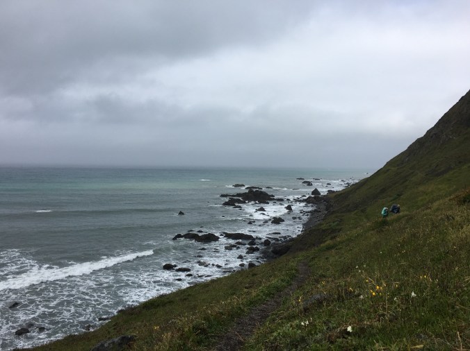
Yeah, I’d say it’s scenic
We spent three days hiking along the coast marveling at wild flowers and sea creatures. The trail itself is easy to navigate, but hiking on sand was a new experience for us. Sand is tiring and slopes into the ocean leaving legs unevenly sore. I am now keenly aware of what it would be like to have one leg shorter than the other. While campsites are not designated along the trail, it’s pretty easy to spot good sites close to fresh water access. Our second night, we passed up too many good sites and ended up having to hike uphill, away from the ocean for quite some time to find a suitable spot.
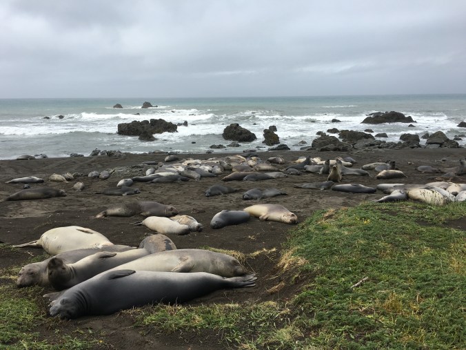
Yes, I probably got too close
The trail meanders inland from the beach in stretches, but the ocean is always visible. We spent an hour one afternoon watching the whales migrate north to pass the time for the tide to lower and our route to become passable. The next day, we watched a river otter frolic around in a stream while we pumped drinking water.
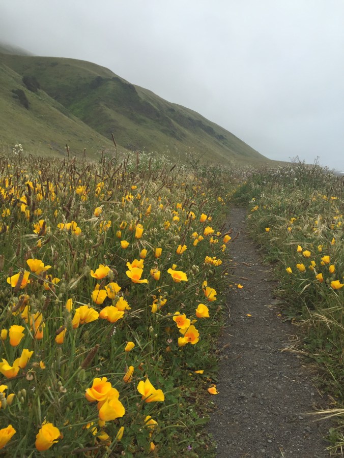
California Poppies

Likely my favorite campsite of all time
A few other things to know:
- there are definitely bears in the area – we saw the prints in the sand
- long pants are a must – the area is covered in poison oak
- you are supposed to poop in the sand on the beach – I’ll let someone else explain that
- never turn your back on the ocean
- you must have a permit to start a campfire
- Humbolt County is known for its rouge marijuana fields on public lands, and as a result, there were some interesting folks wandering around the desolate roads between Black Sands and Mattole
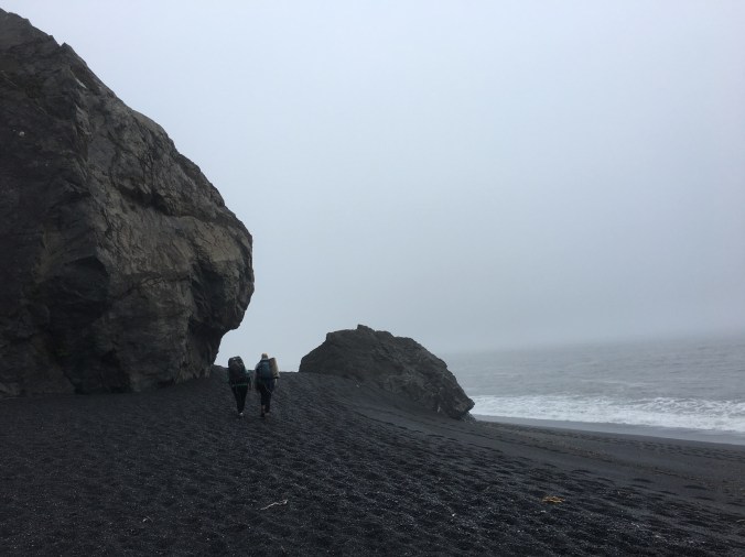
The last mile at Black Sand Beach
We ended 35 miles later at Black Sand Beach with sore feet and big smiles on our faces. There was more car shuttling to pick up the one left at Mattole, but as a wonderful bonus, the drive back to San Francisco treks right though the Humbolt Redwoods State Park. I love the ocean, but I also really LOVE redwoods trees. I made my tired and hungry friends stop the car while I marveled in their glory – and hugged a few trees too.

